The 16th International Geography Olympiad was held just three weeks ago in Hong Kong, from 30th July - 5th August 2019. It was an absolutely incredible week - and I feel so thankful to have had the opportunity to meet with other students from around the world, explore the rocky, green and vertical sides of Hong Kong, and compete on the world stage through 3 academically rigorous tests.
As with last year’s Olympiad, I’m delighted to share my experiences of iGeo 2019 on the blog, and if you have any questions about the Olympiad, please don’t hesitate to get in touch!
Day 0/1 - Travelling to Hong Kong (30th July)
The exciting adventure began at last, after months of anticipation, as I finally met the rest of Team UK at London Heathrow before our departure to Hong Kong. They were such a lovely and enthusiastic bunch, and I couldn’t have hoped for better teammates to spend my precious moments in Hong Kong with!
The plane flight was unusually relaxing for me, despite the time zone changes to get used to, with the opportunity to sample Blueberry Juice (a Finnair signature) - which was rather quite delicious - and a chance to power through some iGeo revision flashcards.
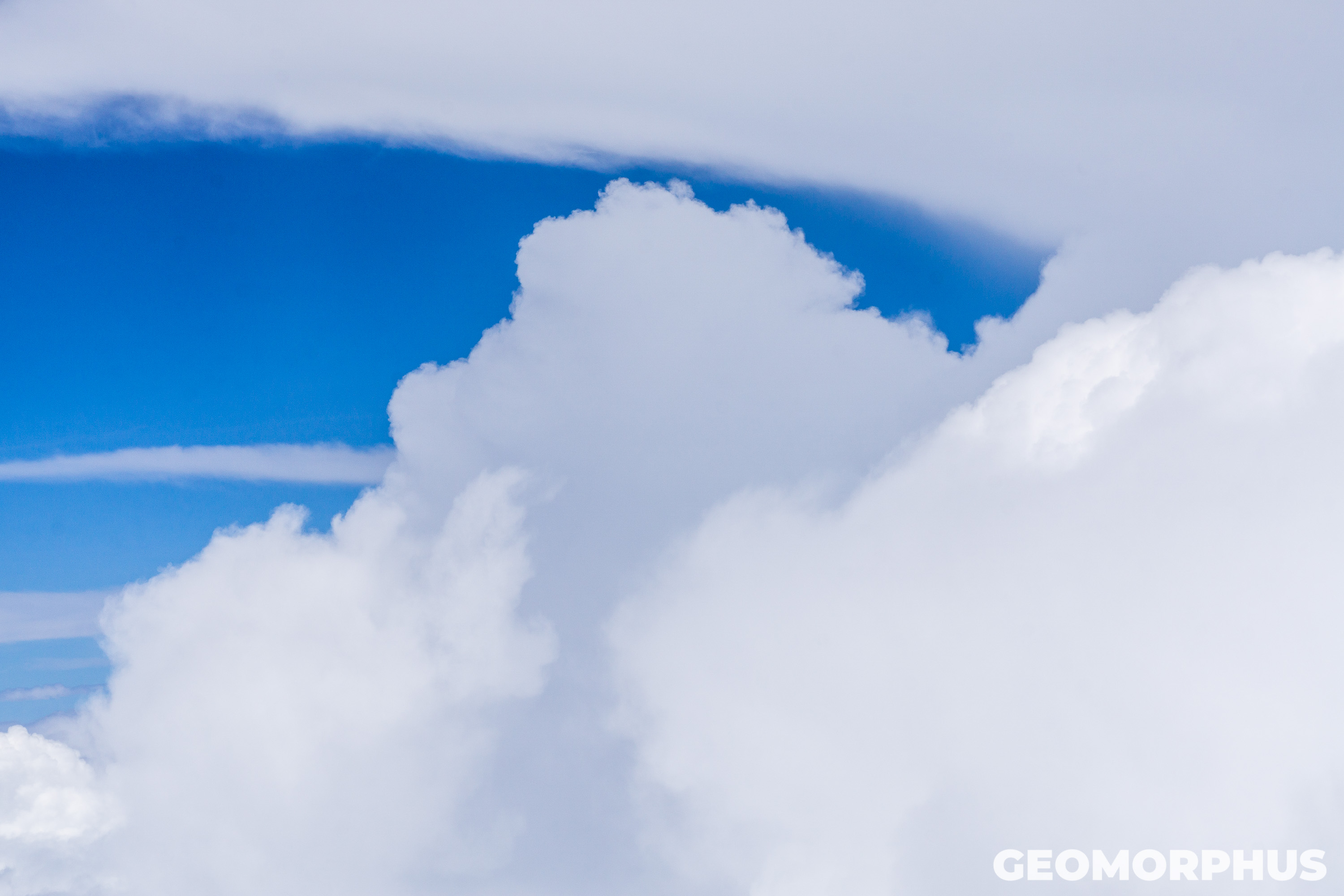
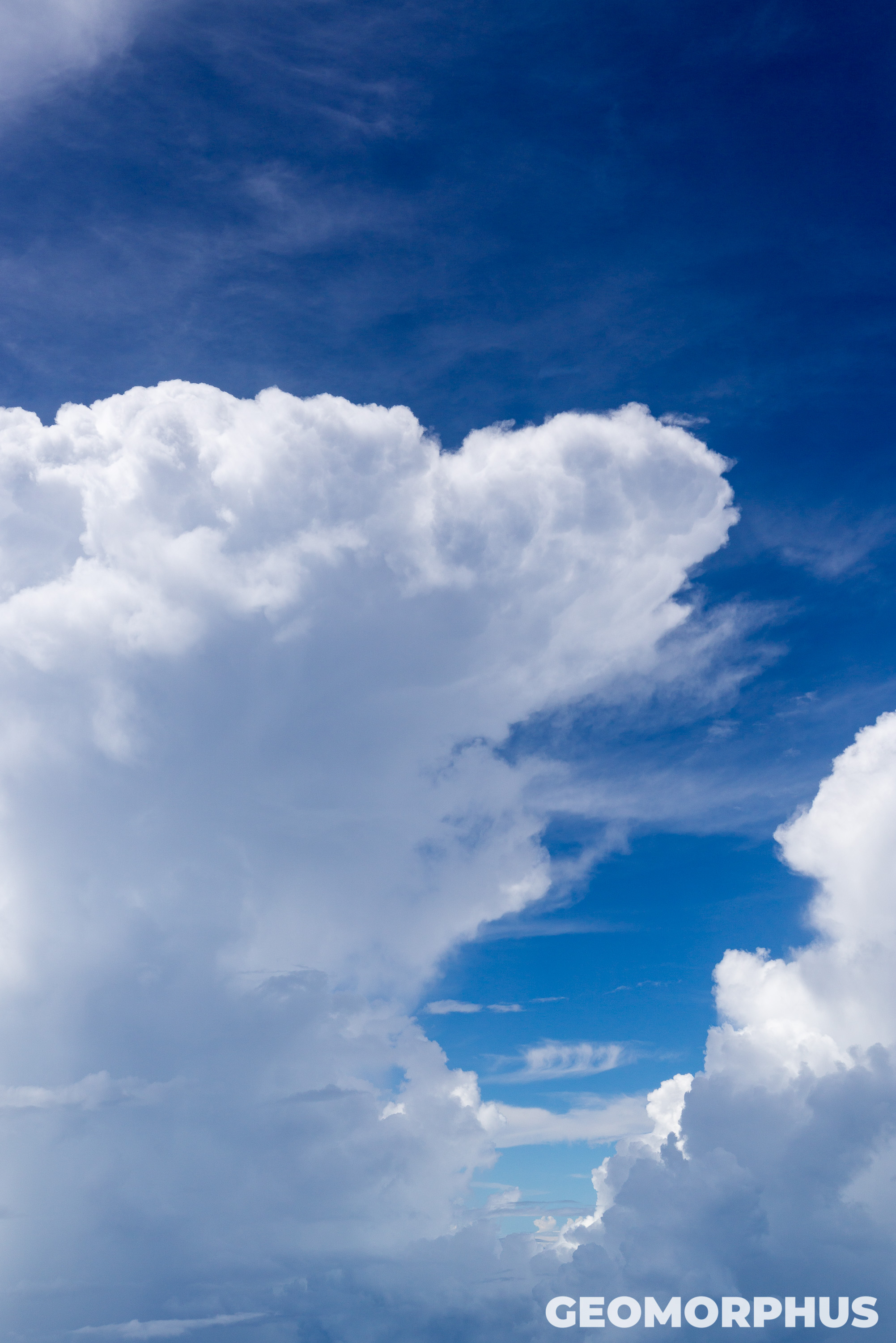
At last, after 14 hours of travelling, we landed in Hong Kong through a flurry of cumulonimbus clouds, while being treated to a stunning view of Victoria Harbour, the city and the wider region from the air. Once landed, with our Octopus cards in hand, it was time to head to EdUHK to register for iGeo, with the help of the iGeo ambassadors who made the week run so smoothly!
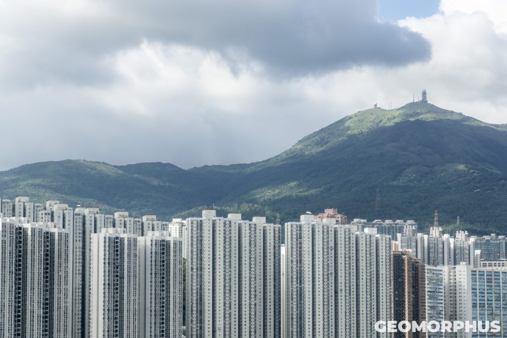
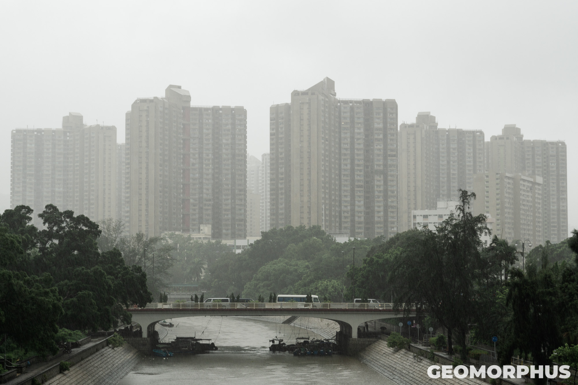
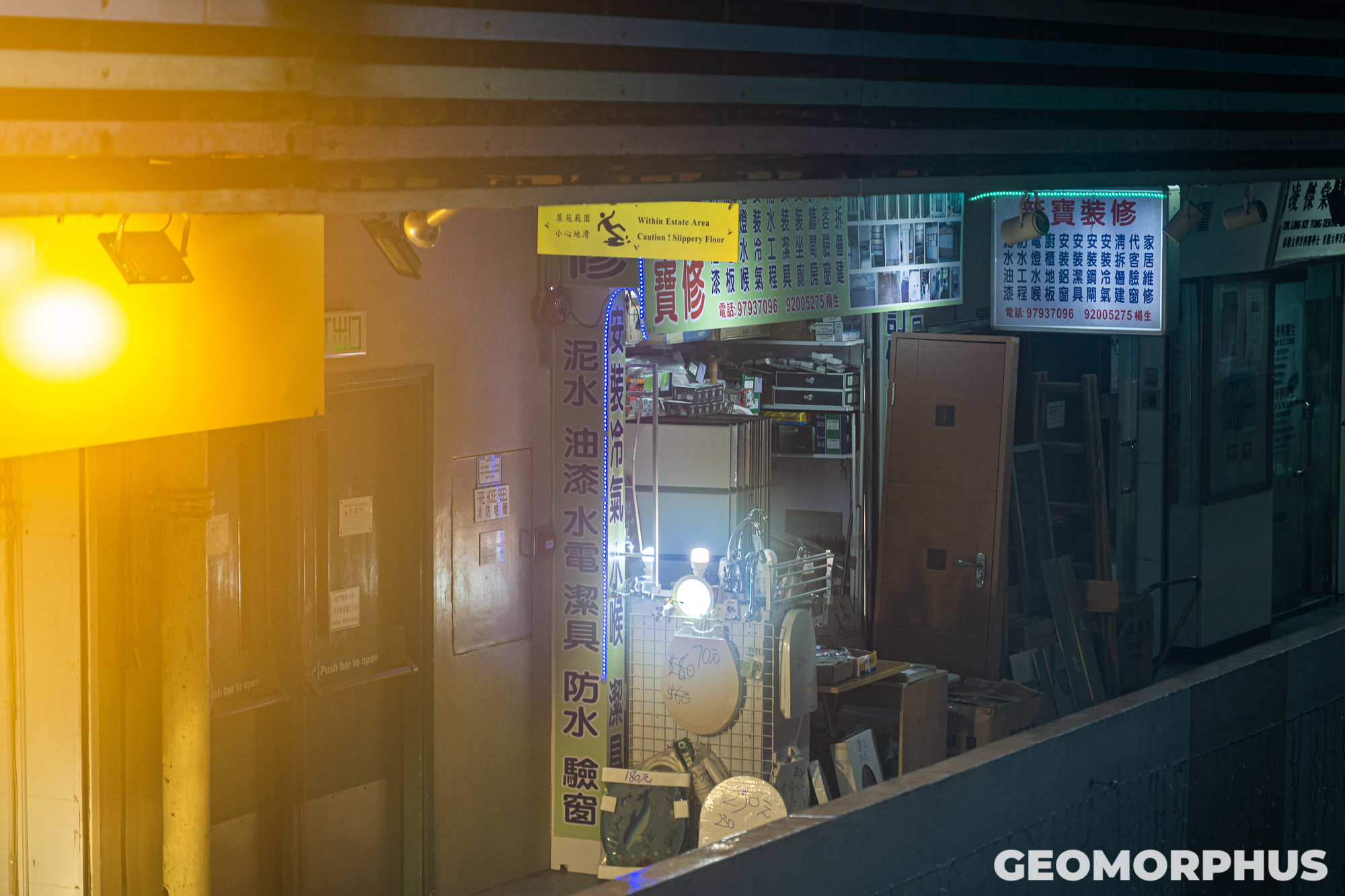
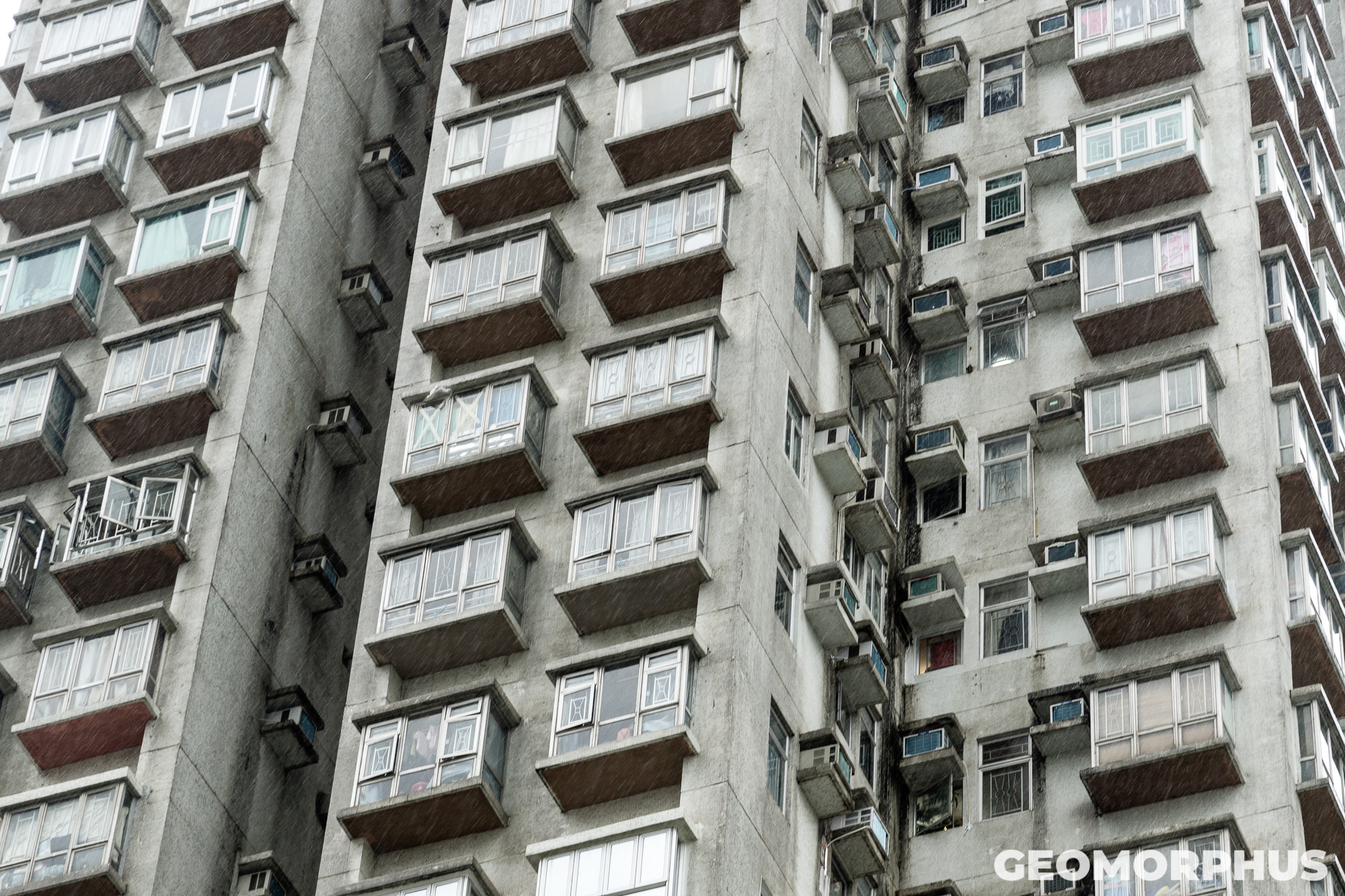
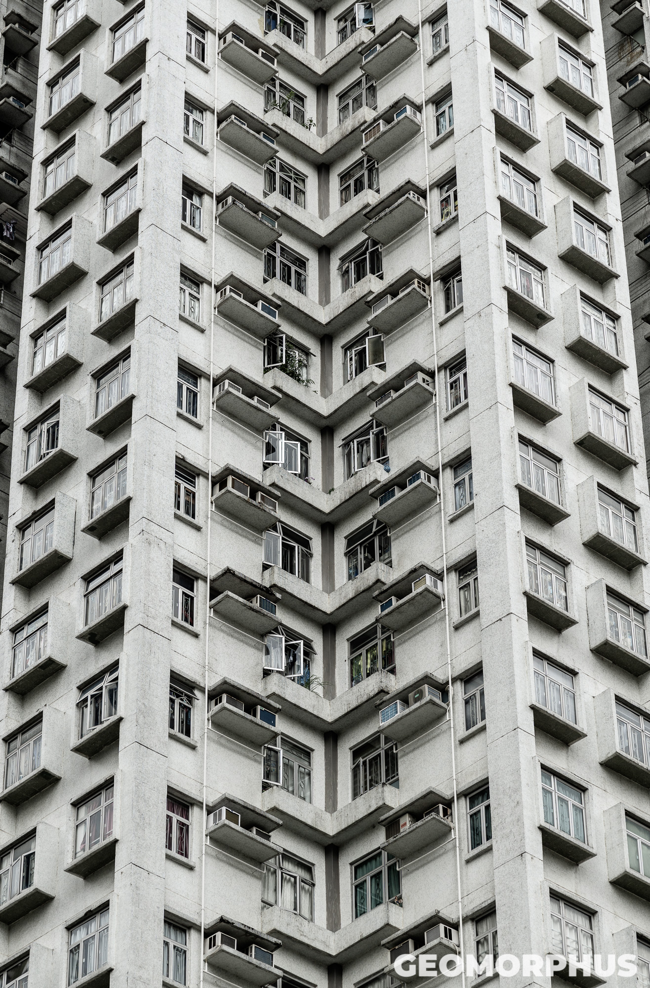
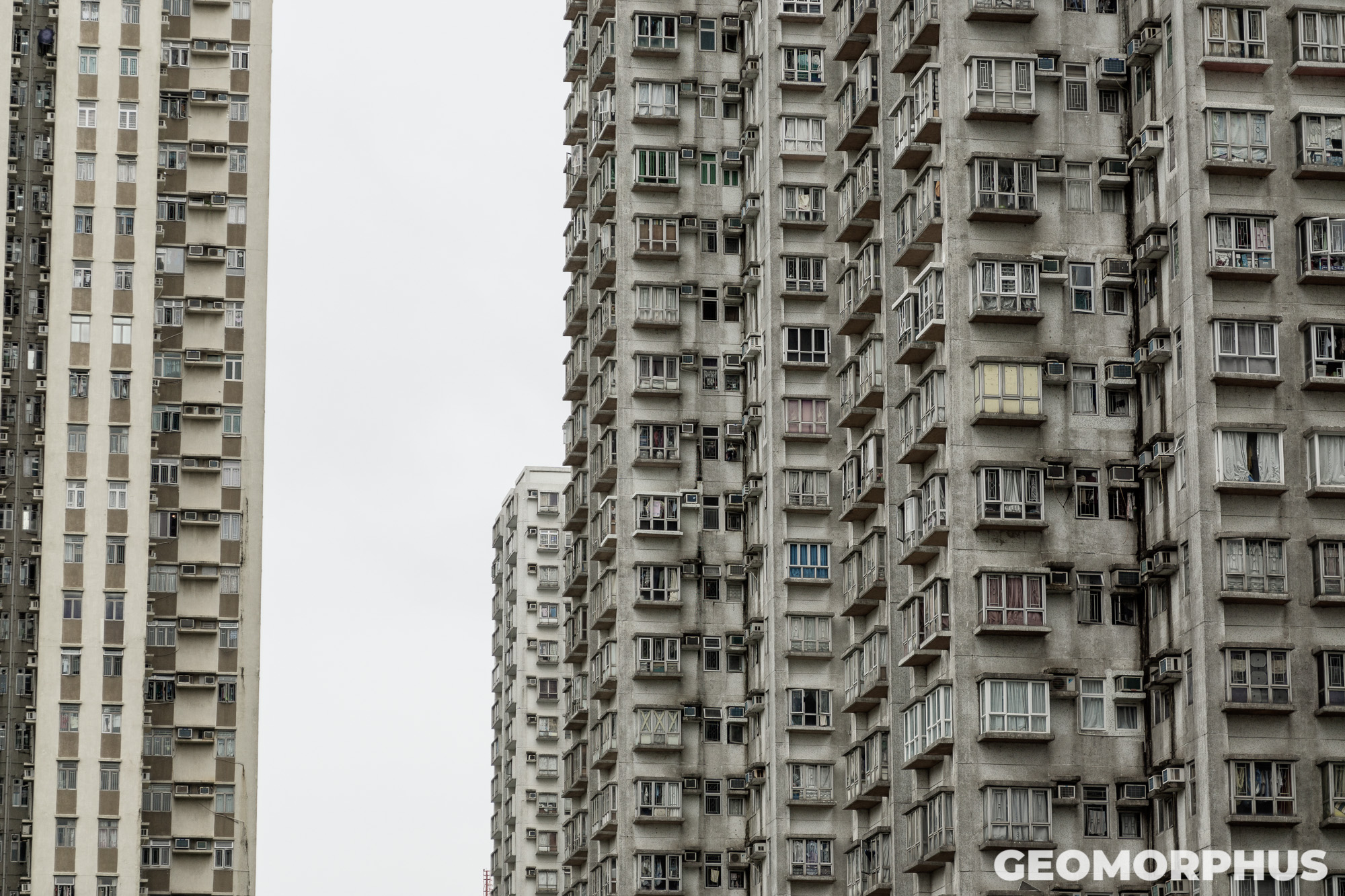
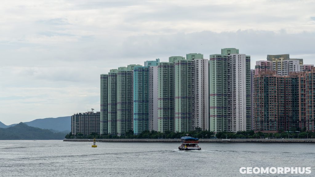
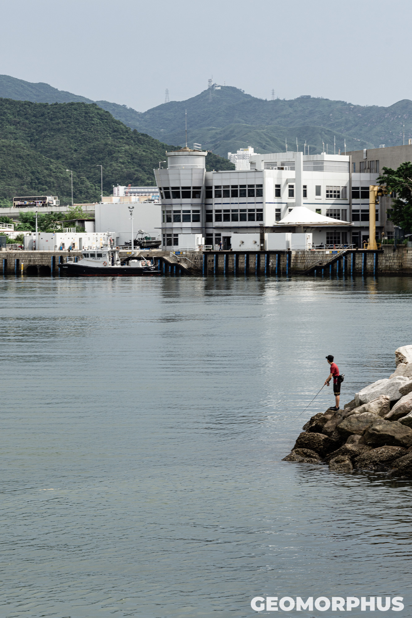
The drive to the university on the coach flew by, and was a fantastic taste of our urban experiences to come in Hong Kong. En route we passed a wide variety of different tower blocks, confirming the notion that the urban areas of Hong Kong are extremely vertical, a fact visually confirmed from seeing only a tiny snippet of the city!
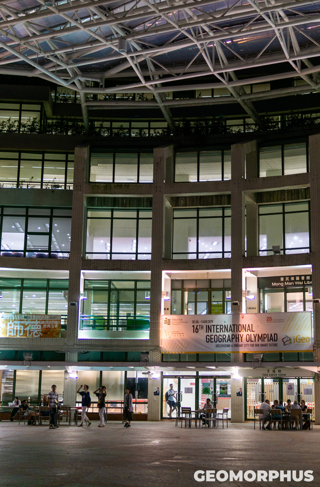
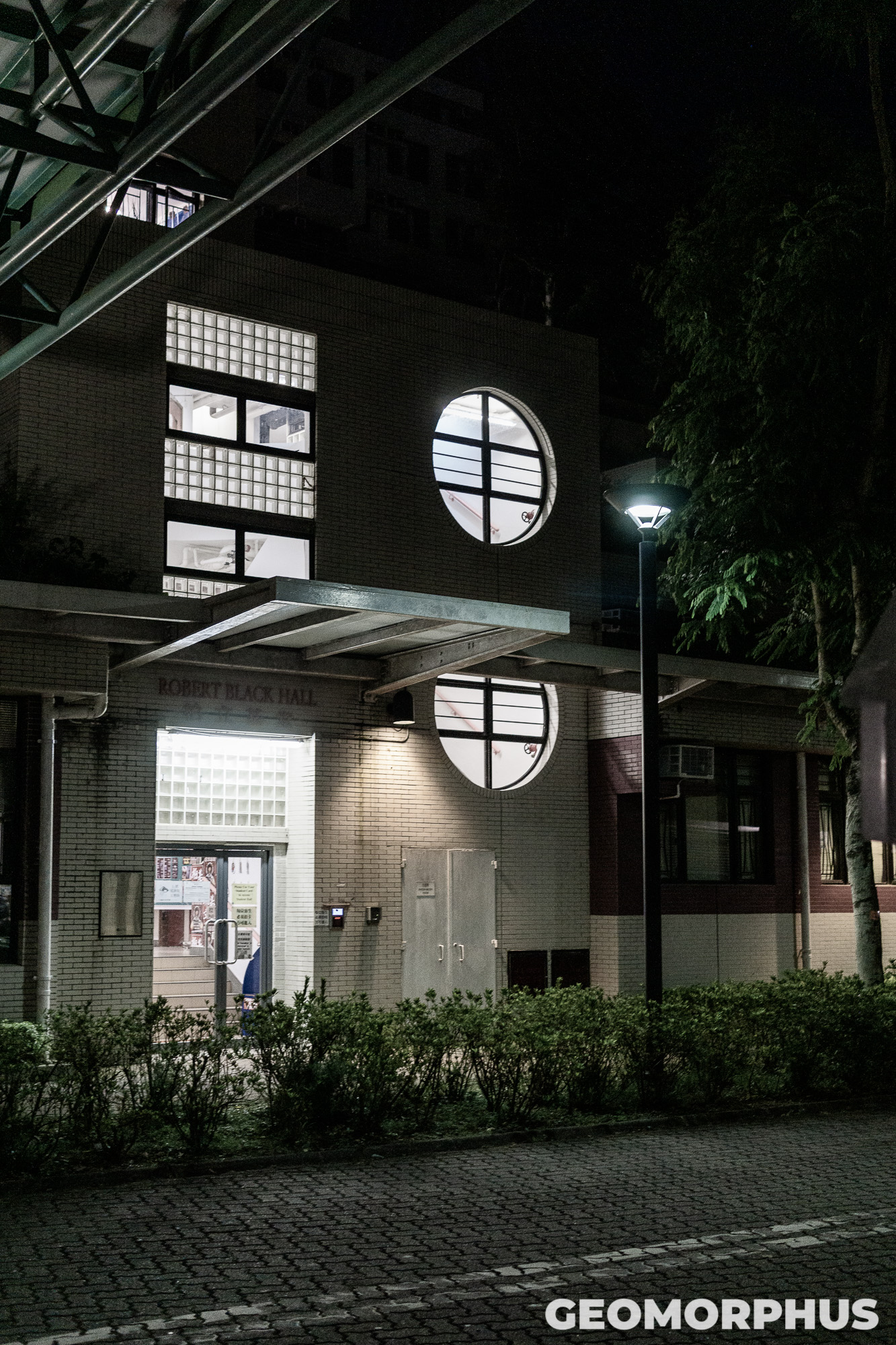
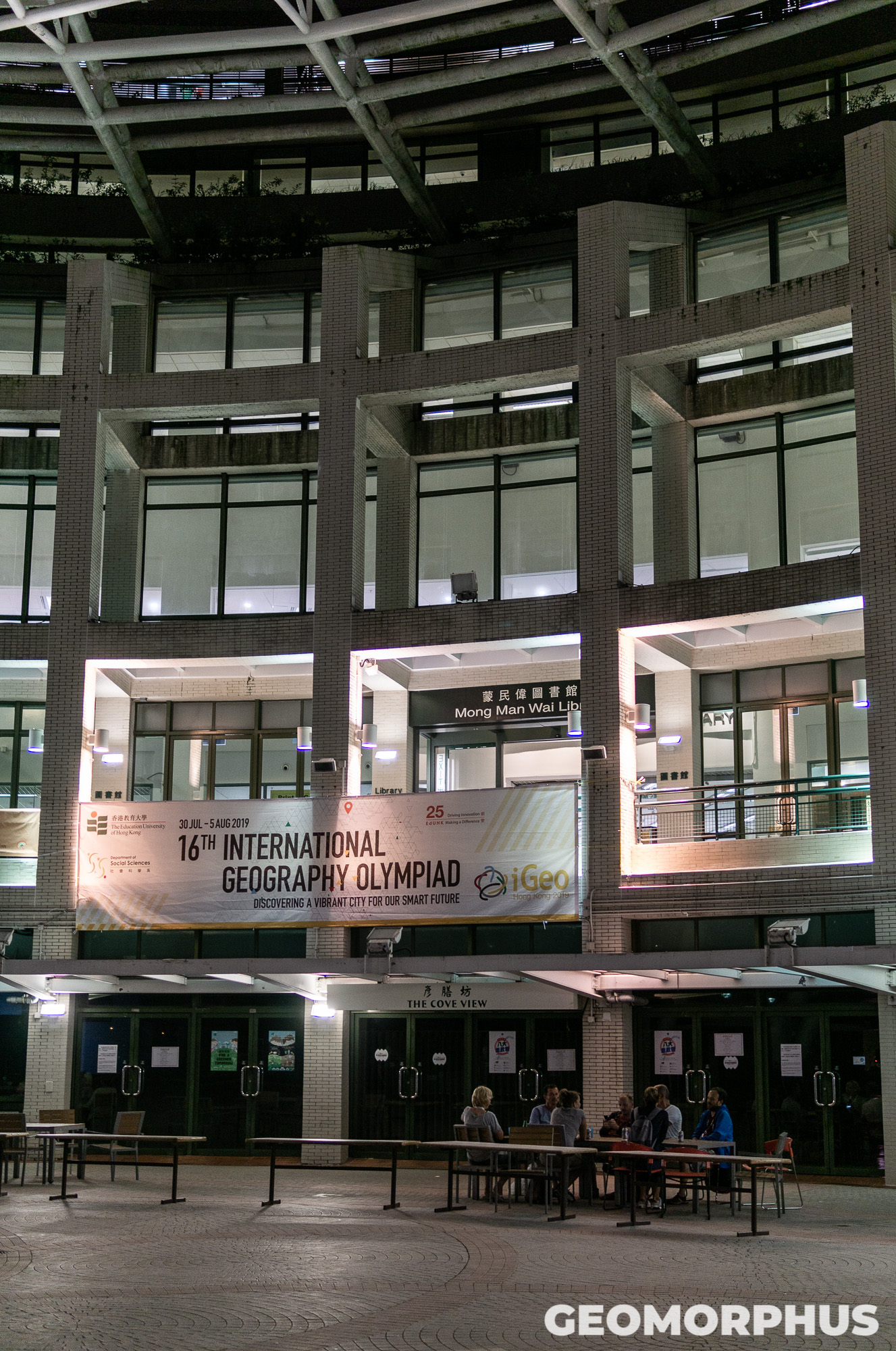
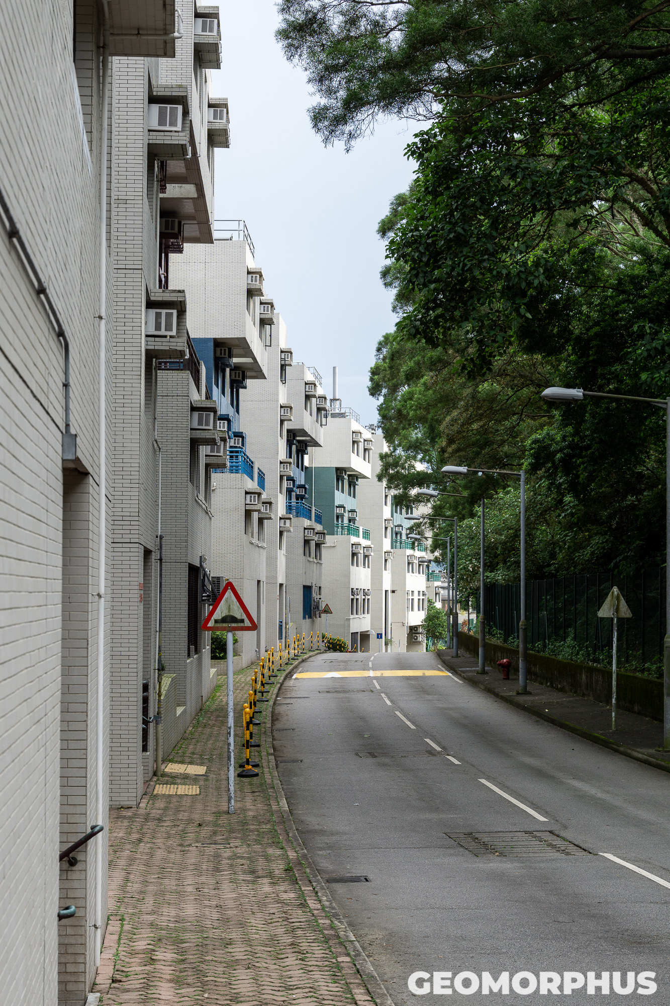
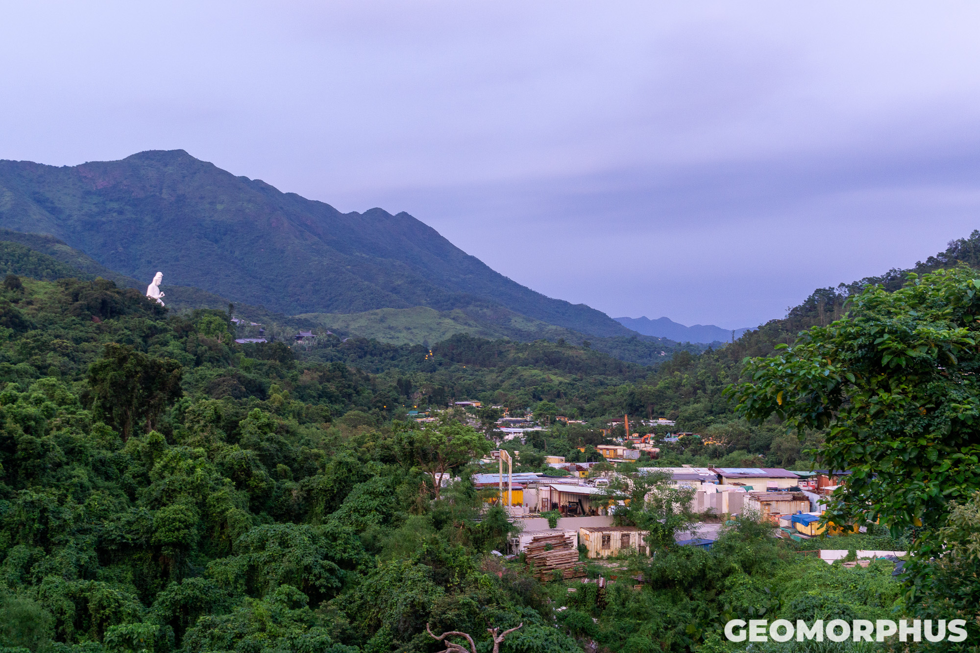
EdUHK (Education University of Hong Kong) was a perfect base for the Olympiad activities, as it was far enough from the bustle of Hong Kong to be peaceful (situated on a luscious hillside in the North-East New Territories), while still close enough to access the breath-taking geography of the region and to make visits to Tai Po (a nearby urban centre) highly convenient. Thank goodness for air conditioning and shelter throughout the complex too, Hong Kong had a wide range of weather that week, to say the least!

Once we had dropped our bags, I had the pleasure to reunite with some iGeo friends from last year in Québec over dinner (a strangely pleasurable pineapple curry!). This really highlighted to me the unique benefits iGeo - and other International Science Olympiads - yield, since the connections I formed with people from across the globe in Québec were truly invaluable in widening my global perspective. iGeo in Hong Kong looks to enhance this perspective even further!
Day 2 - Opening Ceremony & WRT (31st July)
Now, it was time to get started. The Opening Ceremony this year was something very special. Following introductions from academics, the Olympiad Task Force and the Local Organising Committee (with their talks highlighting the importance and relevance of both the study of Geography and of the Olympiad), we were treated to an incredible Lion Dance performance!
This was a truly special moment, as the spectacular dance plunged us headfirst into Cantonese culture. Indeed, we felt very lucky to see this unique performance, as we visited Hong Kong outside of the main festival season. The dancers enchanted us with their rhythmic and fluid movements, set to a driving beat, and surprised us with beautiful banners made specially for the Olympiad!

Lion Dance - official photo from the iGeo Local Organisers
The ceremony also contained a splash of linguistic flavour as - between introductions made by each participating country (where a mic was passed about the auditorium) - the local organisers introduced us to practical Cantonese phrases throughout the morning, to aid our independent discoveries of Hong Kong’s urban centres later in the week.
The 16th International Geography Olympiad was now officially open!
Afterwards, we had the pleasure to sample local snacks, draw fortune sticks and play games the iGeo Ambassadors had prepared just outside the lecture hall. It was also a pleasure to meet fellow iGeo participants from across the globe (from countries ranging from Indonesia to Bolivia, and from Slovenia to Turkmenistan), as we socialised in the period before the afternoon’s test!
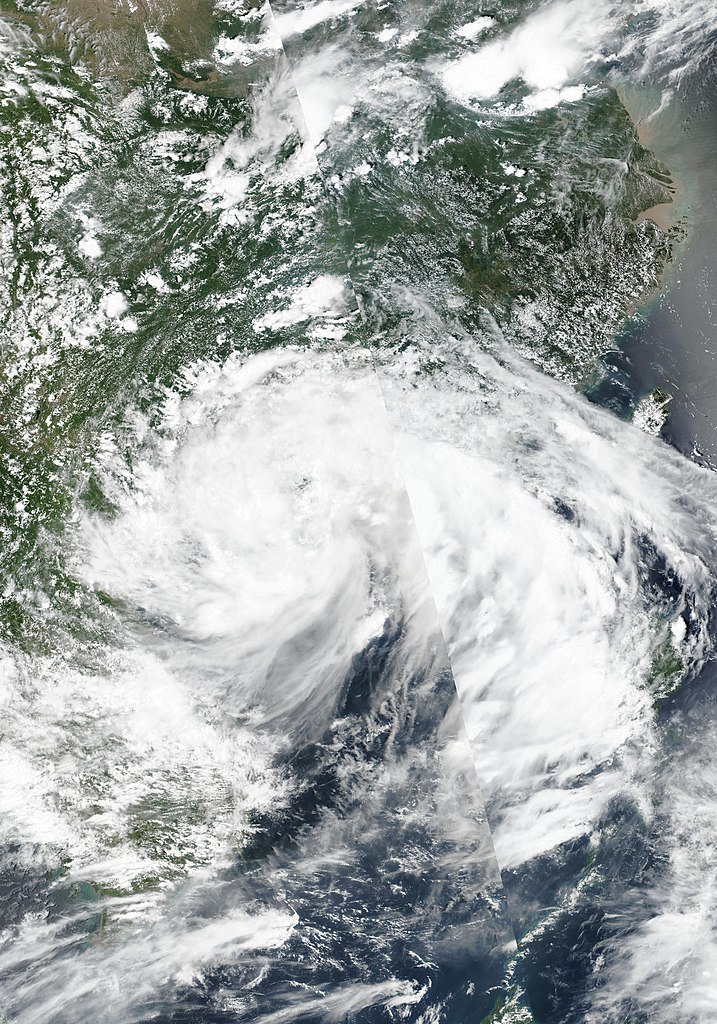
Wipha on August 1st 2019 - By NASA, MODIS / LANCE, https://worldview.earthdata.nasa.gov/, CC BY-SA 4.0, https://commons.wikimedia.org/w/index.php?curid=81025656
Following lunch, it was time for our first test: the Written Response Test (or WRT for short). This took place while Tropical Storm Wipha battered Hong Kong (Typhoon Signal Number 8 was hoisted!). It was certainly an interesting experience to witness some of the weather conditions - although relatively moderated, since Wipha passed just offshore of Hong Kong - associated with these storms. It was absolutely fantastic to connect theory from my studies with real world phenomena!
The Written Response Test itself was certainly a diverse experience, with short-answer questions grouped into 6 sections, ranging from evaluating smart agricultures, to explaining the effects of ocean currents; and from constructing a contour map, to assessing water conflicts on the River Jordan.
After a blustery walk back towards ‘The Cove View’ (the canteen where we had most of our meals), during which we shared our thoughts on the test we just completed, we (Team UK) braced the tropical storm conditions and rested in the relatively sheltered Central Plaza. Here I had the pleasure to brief the team on Fieldwork Skills, and what to expect from the Fieldwork Exercise. It was very cool this year to work with the team by passing on the lessons I learnt from last year’s iGeo fieldwork exercise in Baie-St-Paul.
Following this short interlude, it was time for the Fieldwork Briefing, presented by Dr Fok. This provided the preliminary understanding for the Fieldwork Exercise (FWE) and proved very useful when conducting the fieldwork study! During this session, we were introduced to the basic needs of Hongkongers, the concept of Transit-Oriented Development in Hong Kong and different types of housing developments in the city. The ideas which we were introduced to were thoroughly interesting, and it also served as a forum to clear up our concerns about the Fieldwork exercise, especially in the regards to the weather the following day!
Day 3 - Tai Po & Poster Evening (1st August)
Although the fieldwork was postponed until the following day (due to the adverse weather), and our excursion to Central Hong Kong cancelled entirely, Tropical Storm Wipha wasn’t going to dampen our spirits!
After a morning spent in Pacific Coffee preparing for the MMT (Multimedia Test) with Team UK, and undertaking a team preparation session for the Poster Presentation that evening, we pondered our afternoon’s activities over lunch. This is where our first adventure into one of Hong Kong’s urban centres began - instead of spending the afternoon inside, we headed out to Tai Po with Team New Zealand and Australia.
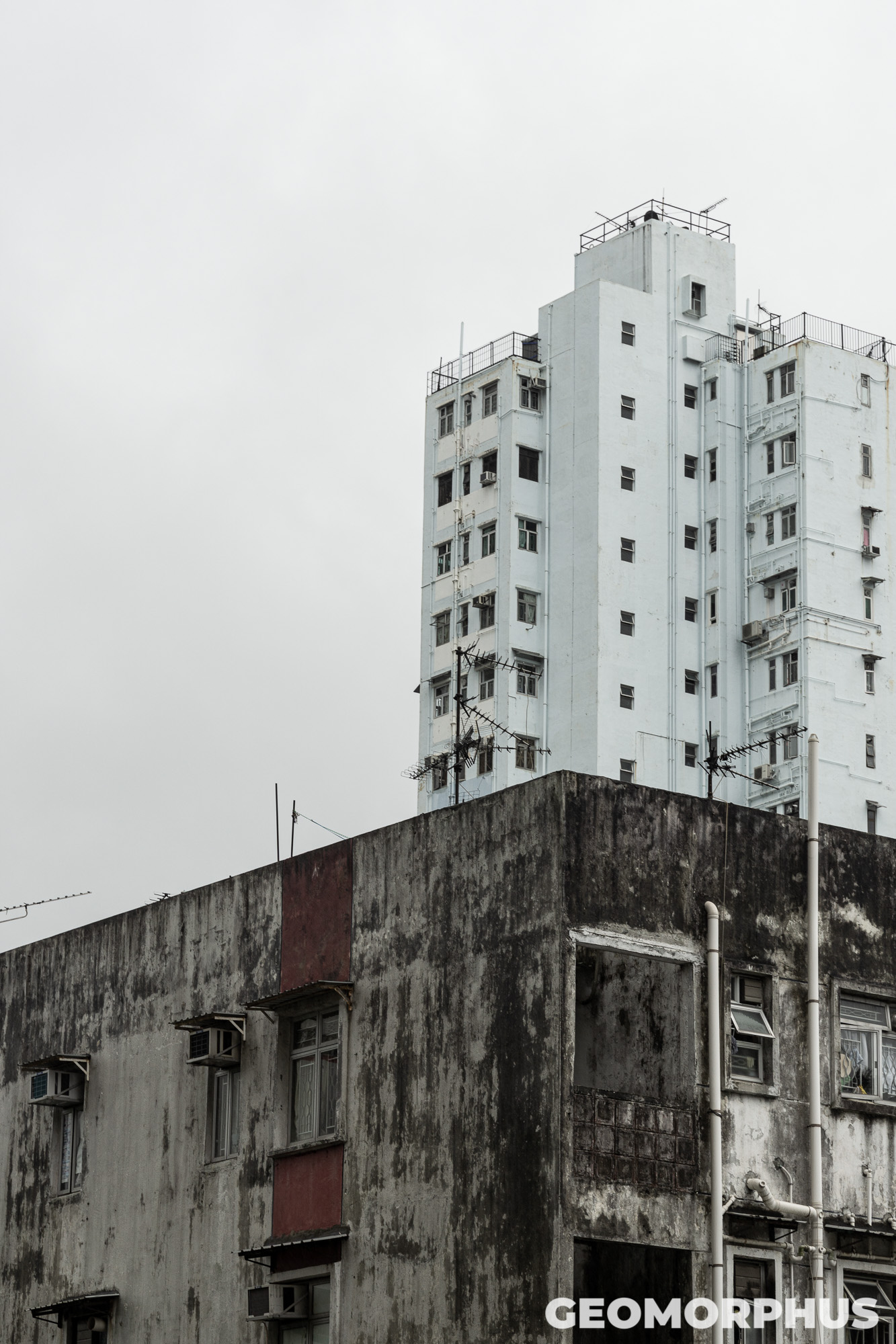
Although our activities were mainly based in the sprawling complex of the Tai Po Megamall, it provided an interesting opportunity to see the different types of retail in the area, but also to cast our gaze upwards towards the impressive tower blocks, which seemed to stretch endlessly into the distance. Indeed, the whole complex was part of a tower podium development common in the New Territories (where several residential towers rise above the lower levels of shops and eateries), which makes sense given the high land values of Hong Kong, and the resulting need to maximise the profit from each plot!
By Dennis Wong - https://www.flickr.com/photos/denniswong/3476645160/, CC BY 2.0, https://commons.wikimedia.org/w/index.php?curid=29597137
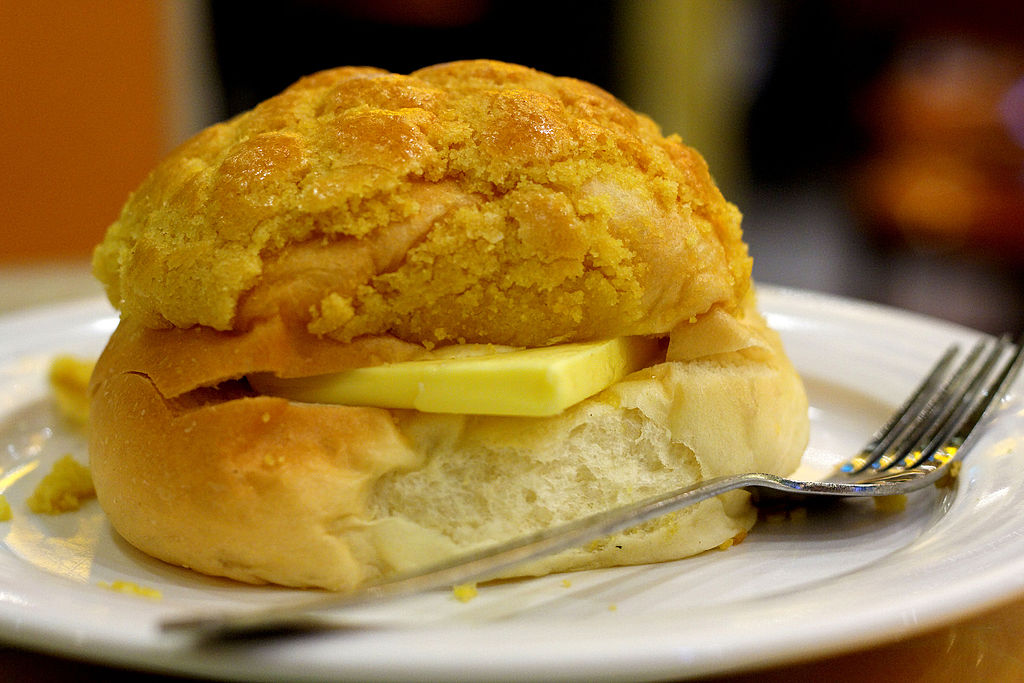
During both visits to Tai Po that week I also sampled the delicious pineapple bun, a popular sweet bun in Hong Kong. The pineapple bun (blo lo bao / 菠蘿包) doesn’t actually contain pineapple, instead it is named after its topping. Its delicious top crust has a fragmented, golden-brown appearance, similar to the skin of a pineapple. The buttered pineapple bun (boh loh yau / 菠蘿油), which I also tried, is similar to the pineapple bun, but also has a large slab of butter inside (which pokes out of the bun like a slice of pineapple!). They were both beyond delicious, and I’ve been craving them ever since!
Our bakery explorations over, we headed back up to EdUHK for an impromptu cultural session. This was an excellent opportunity for inter-cultural communication, with acts devised by participating teams to share their cultures with other countries.
During the afternoon, there was beautiful singing from Teams Mongolia and Russia; unusual dances from Taiwan, Turkey and Thailand; our questionable Don’t Stop Me Now performance, backed by teams Australia and New Zealand; and a massive Kahoot! from Team Denmark (this being the largest one I’ve ever participated in!).
The evening saw an extension of this inter-cultural exploration with the thoroughly interesting Poster Presentation. The theme this year was on one of my favourite topics: Smart Cities. In the run up to the Olympiad, we created posters in teams about different Smart Cities in our respective countries, underlining how Smart City approaches were promoting sustainability.
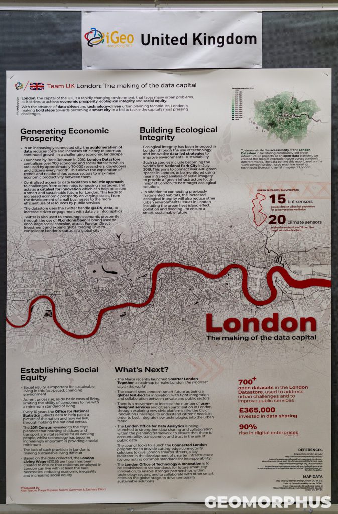
The session was pretty awesome. As a team, we presented our London: The making of the Data Capital poster to other participants. It was fantastic to share how London has implemented Smart City principles to improve the sustainability of its systems, and what’s coming next, with other students. There was also a good challenge to our argument, through the interesting questions posed by the judges.
Beyond presenting, the evening also gave us a chance to explore Smart Cities across the globe, as other students presented their posters to us. To give a flavour of the fantastic posters I checked out, they ranged from highlighting transport links in Bolivian cities like La Paz, to a green Warsaw; citizen participation in Belgium, to social resilience in Christchurch; liveable development in YarraBend (Melbourne), to future-proof cycling infrastructure in Utrecht; and from developments throughout Latvia, to the smart Estonian city of Tartu.
Day 4 - Fieldwork Exercise (2nd August)
It was time to get cracking on that Fieldwork Exercise (FWE).
Our first Fieldwork task was very cool, based in the Promenade area of Sai Kung (a destination only revealed to us once we had arrived in the town!). This involved observing the uses of the promenade by local residents, mapping and assessing the value of coastal protection schemes (both from an engineering viewpoint and in terms of human use), alongside the identification of transport links from Sai Kung (via light bus, bus and ferry) to the rest of Hong Kong (recorded on a table and map).
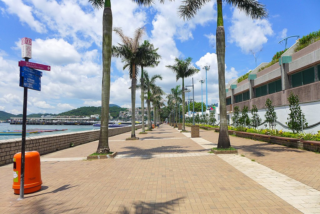
Sai Kung Waterfront - By Wpcpey, CC BY-SA 4.0, https://commons.wikimedia.org/w/index.php?curid=61125617
Our second task, after lunch, was based in the town centre of Sai Kung. Despite being challenging - as we had to cover a wide area of the city in a short period of time - the activity was rather enjoyable. The task involved mapping land-use, building height and building type across extensive transects on a draft map, before transferring it to a neat map while in the field.
At the core of this was the need to design an efficient and appropriate classification system (to record all the required data, while still being easy to use and quick to implement). Since I used a detailed classification system, my data collection was very complex and time-consuming, inducing a frantic episode of cartography on a park bench near the end of the exercise! It was good fun to complete the task nonetheless.
After we’d returned to EdUHK (and freshened up from the hot humidity typical of summers in Hong Kong), and had dinner, we had an evening exam scheduled for the Fieldwork Analysis. This was the first time I’d had an exam in the evening, so it was quite the experience!
The analysis session was surprisingly enjoyable. The task saw us build upon our observations earlier in the day through a calculation and mapping exercise; called on us to identify the functions of Sai Kung, and the urban problems the town faces; and asked us to propose a new development for the town to help solve its urban problems, by building upon its existing functions and being appropriate to what we observed earlier in the day. For this, I planned an area of mixed land use to improve walkability, sustainability and connectivity to key business centres.
Day 5 - MMT & Cultural Evening (3rd August)
The final test that week was the Multimedia Test (MMT). This test focuses on geographical thinking and problem solving, rather than relying solely on knowledge. The MMT itself comprises of 40 questions: each involving a question, an item of media (such as a photo, graph, map or video clip) and 4 multiple choice answers.
Once the tests were over, it was time to unwind. Drawing mental maps of the world (for a research project), and the discussions that followed, certainly encouraged the building of relationships ahead of the cultural afternoon.
In the few hours of free time that we had, the team (along with some of Team Canada, Australia and New Zealand) headed down to Tai Po. This was another fantastic opportunity to explore the urban centre - taking in the tower blocks from a rooftop garden and having an eye-opening visit to the Tai Yuen Wet Market. The trip also offered a chance to sample some delicious food, including a curry and yet another pineapple bun!

The Cultural Afternoon was an interesting, and really fun, experience, with sessions on the area’s tourist attractions, basic Cantonese, calligraphy and a fan making workshop. Finally, as a group, we prepared a performance for the evening.
The Cultural Evening was a very special occasion - as we shared the performances we created in groups with other iGeo participants. They ranged from a dramatised account of our experiences in Hong Kong so far, to a whistle-stop tour of Hong Kong’s main tourist attractions; and from a quiz on what we had learnt, to our fan dance and short play. The evening was very cool, with a lovely atmosphere and amazing performances by all the groups!
The rest of the night was also pretty awesome. We started with chilling out in the Lower Podium Level with many of the friends I made that week. Back upstairs in the Central Plaza, the Netherlands team leader was playing some cool tunes, and there was even more socialising! Somehow I got involved in a crazy long game (well, 40 minutes isn’t that long compared to the world record of 24 hours) of twister - although they called this version Belgian-Dutch Wrestling:which is like normal twister, but with delicious food items instead of colours! It was pretty cool to play, and the pictures of food left us hungry by the end!
This was such an incredible day, and especially evening, as we stayed up late to meet each other and unwind following some pretty intense tests! I will definitely be remembering this night for a long while.
Day 6 - Excursion to Global Geopark (4th August)
Today we were to explore the stunning natural side of Hong Kong, basing our activities in the Hong Kong UNESCO Global Geopark - a 150 sq. km area in the New Territories. Our explorations were focussed in the Northeast New Territories Sedimentary Rock Region of the park: an area of spectacular weathered terrain and colourful rock outcrops (including siltstone and mudstone), with significant oxidation occurring in its geological history.
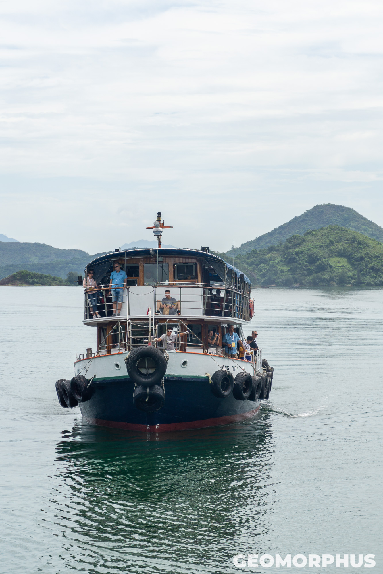
The day started with an incredible boat journey towards Lai Chi Wo from Ma Liu Shui, passing by the impressive tower blocks of Ma On Shan and travelling beside a range of islands with verdant vegetation and intriguing rocks, viewed from Tolo Channel (赤門海峽) and Double Haven (印洲塘). It was interesting to note how Tolo Channel is evidence of a significant geological fault in Hong Kong - marking the boundary between sedimentary and igneous geological regions.
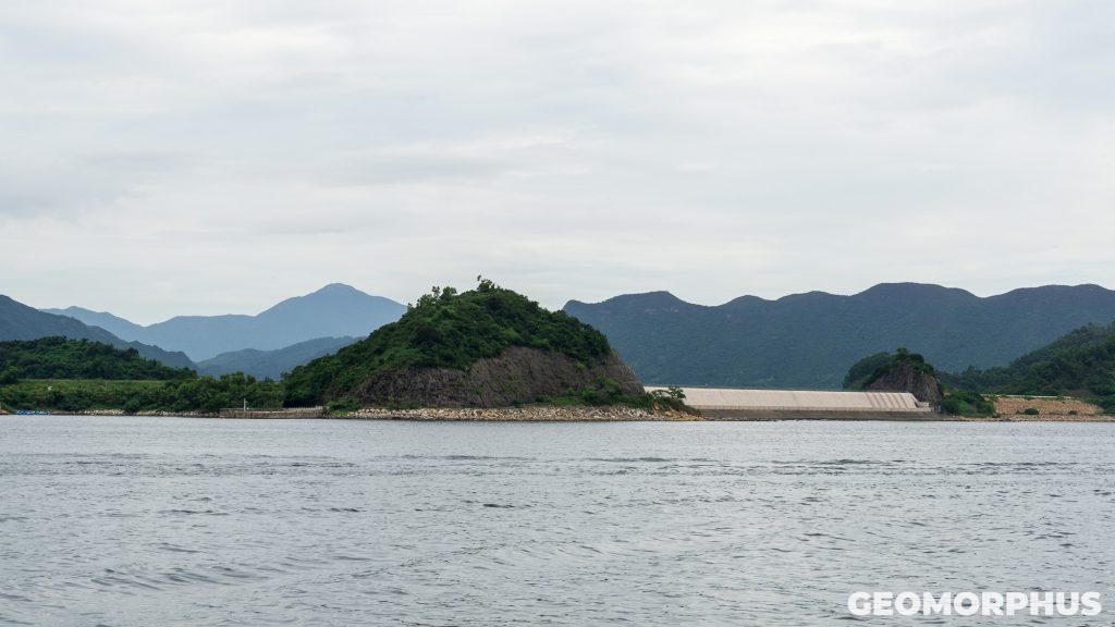
The Plover Cove Reservoir (船灣淡水湖) was one of the many landmarks that we passed on the ferry ride. As the second-largest reservoir in Hong Kong in volume, at 230 million cubic metres, it is a valuable water source for much of Hong Kong’s population - gathering rain from its catchment and holding water imported from the East River, China. The 2km dam that separates it from the sea is equally impressive, especially since it is the world’s first reservoir to be reclaimed from the sea.
One particular highlight of the outbound journey was Wong Chuk Kok Tsui (黃竹角咀), where the oldest layers of rock in Hong Kong can be seen. Here sandstone has been folded and tilted into near-vertical bedding planes, which made for an impressive sight from the ferry!
Once we had landed at Lai Chi Wo, we were in for a very special experience. From explorations of the historic walled village (which has just 2-3 permanent residents) to the impressive surroundings of mangroves, fields and rolling hills, we were in for a spectacular morning. The short talks by the guides at each point of interest were also thoroughly interesting, transporting us back in time through the history, geography and development of the village.
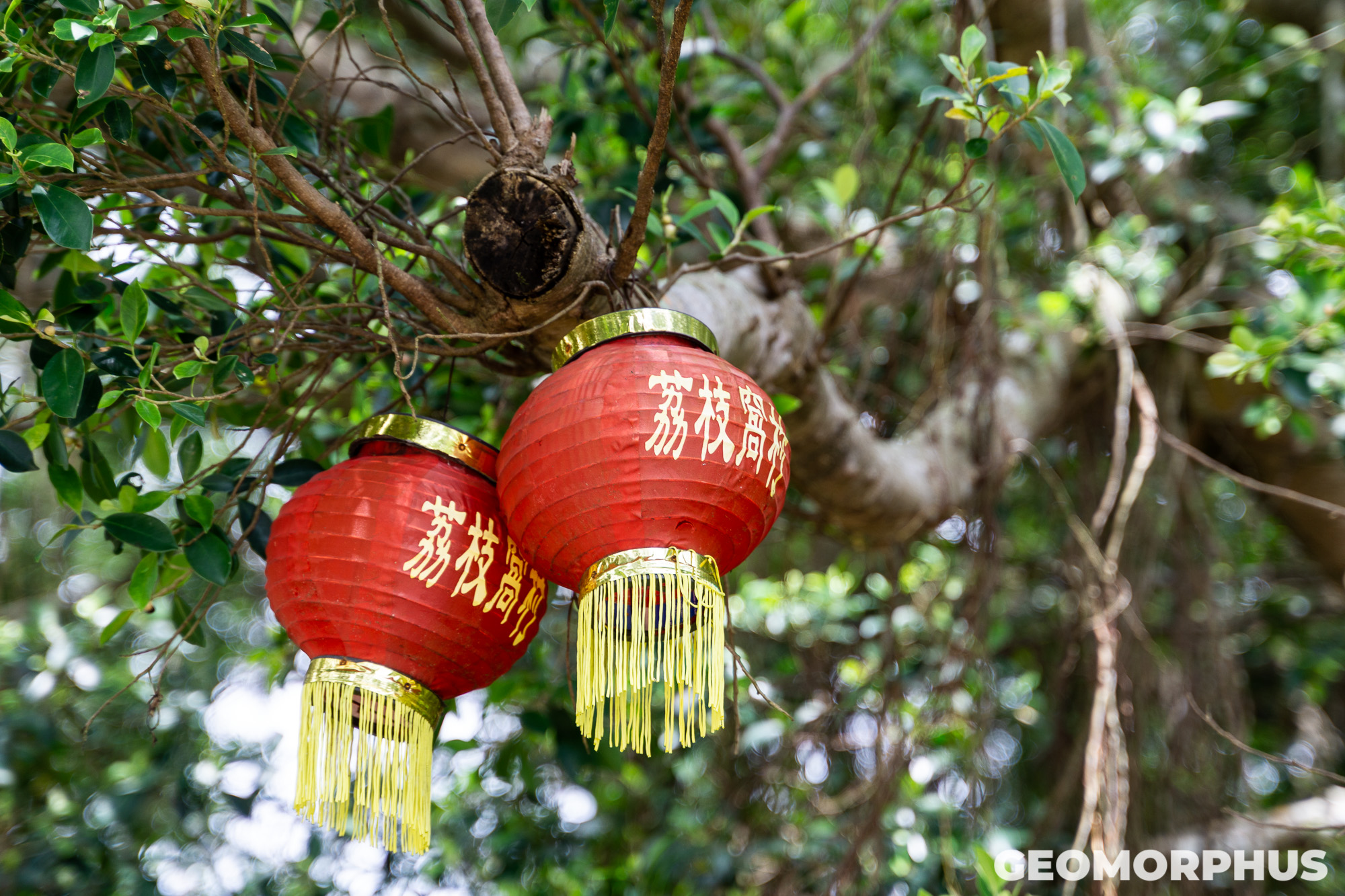
Lai Chi Wo (荔枝窩) itself is a traditional Hakka village located in the Plover Cove Country Park. With a 400-year history, the settlement had plenty of heritage for us to explore, with its development particularly intriguing. As the guides explained, about a century ago, Lai Chi Wo was a poor village. The solution, which returned the prosperity to the town, was the building of 3 Feng Shui walls to get rid of the evil spirits in the village, and to protect the residents' assets. Reportedly, the establishment of the walls provided the village with renewed prosperity.
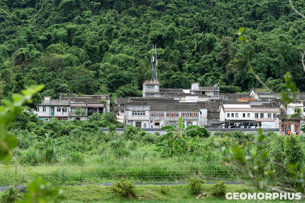
However, as I noted earlier, the village now has few permanent residents, a significant contrast from the hundreds of residents in its most prosperous period. This is because of poor economic opportunities here to meet the needs of younger residents, such that they emigrated overseas or to urban centres like Tai Po. It was certainly intriguing to discover how such factors have shaped the function of Lai Chi Wo over time.
More recently, the area has seen significant rural regeneration, through the opportunities for education and heritage discovery provided by its UNESCO status, and growing visitation with the rise of geo-tourism packages and boat trips.
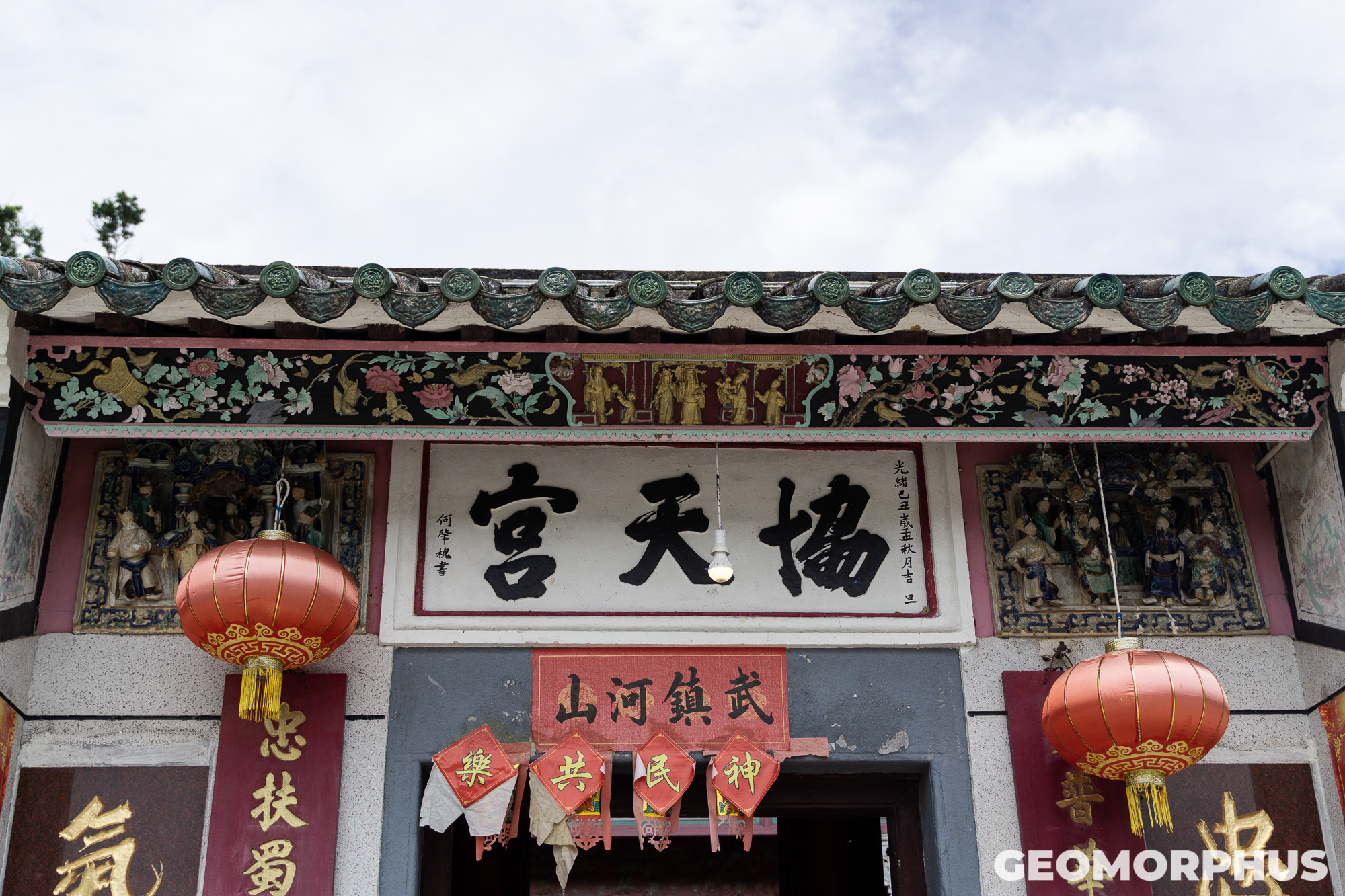
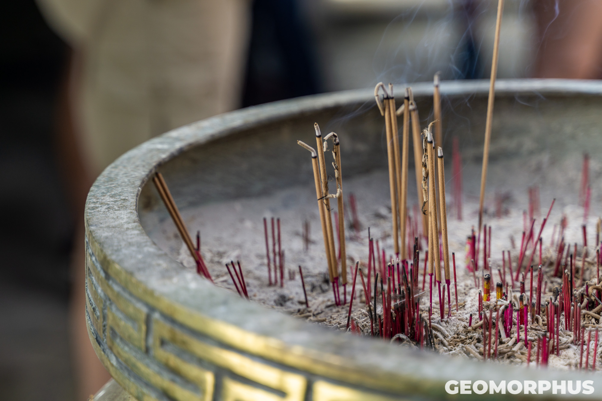
Some particularly arresting features in the village were the Hip Tin Temple and Hok Shan Monastery, within which thick plumes of incense wrapped themselves around the traditional architecture and nestled among its exquisite features. With a history of over 200 years, the structures were built by the 7 villages in the region to draw good fortune into the area and expel evil forces. This was a wonderful immersion into Lai Chi Wo’s cultural heritage.
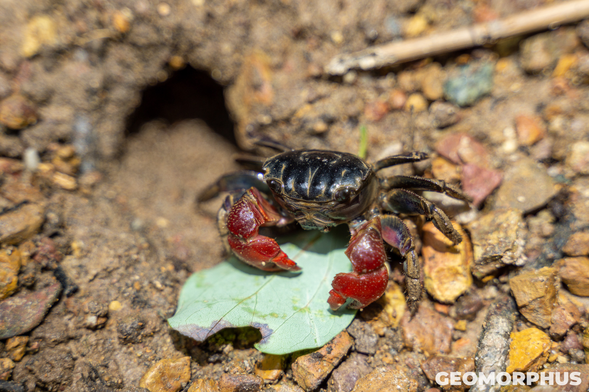
The portion of the Lai Chi Wo Nature Trail passing through the mangroves was particularly rewarding for me. As an ecosystem I’d encountered throughout my studies at High School, it was a blast to see a prime example with my own eyes. Such observations ranged from watching the crabs scuttling about the mudflat, to the buttress roots reaching down towards the sea; and from the mangrove seeds dropping into the water with a subtle splash, to the plants' halophytic adaptations to their harsh environments.
After lunch, we left dry land once more to embark on a boat tour through Crooked Harbour (吉澳海) and back to Ma Liu Shui.
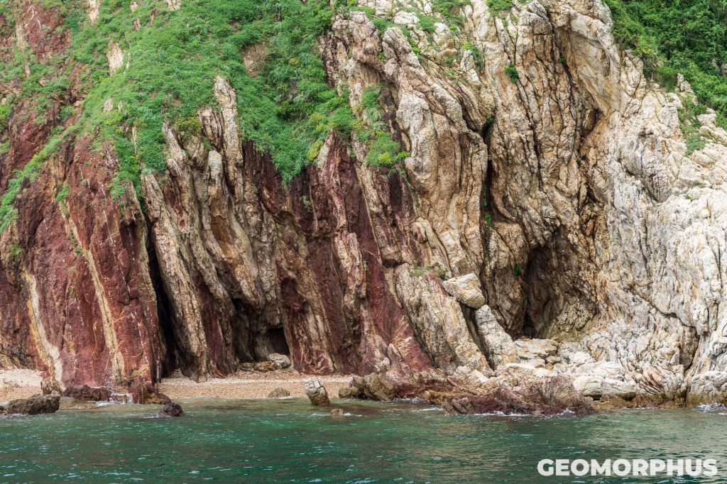
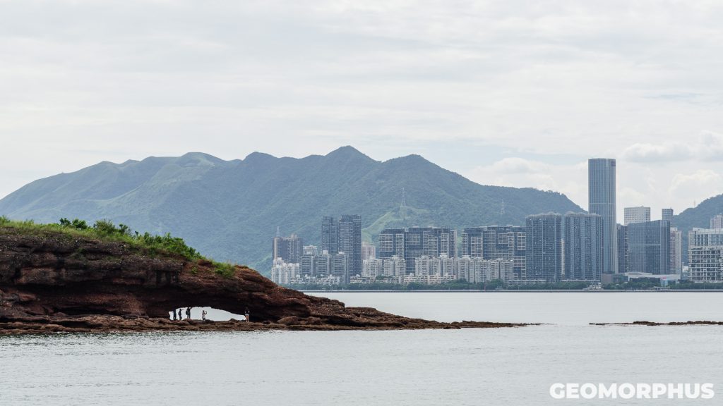
The return journey began with a close pass alongside Ap Chau (鴨洲). Despite being the smallest inhabited island in Hong Kong - at just 0.04 sq. km in area - it certainly punches above its weight in geological intrigue. Ap Chau is composed of a reddish-brown breccia (made up of large fragments of broken rocks and given its distinctive colour through the oxidation of iron held within the rock) and has a remarkable Northerly tip. This end of the island features an iconic natural sea arch - nicknamed Duck’s Eye - that marine erosion processes have fashioned out of the breccia in a period stretching over 8000 years.
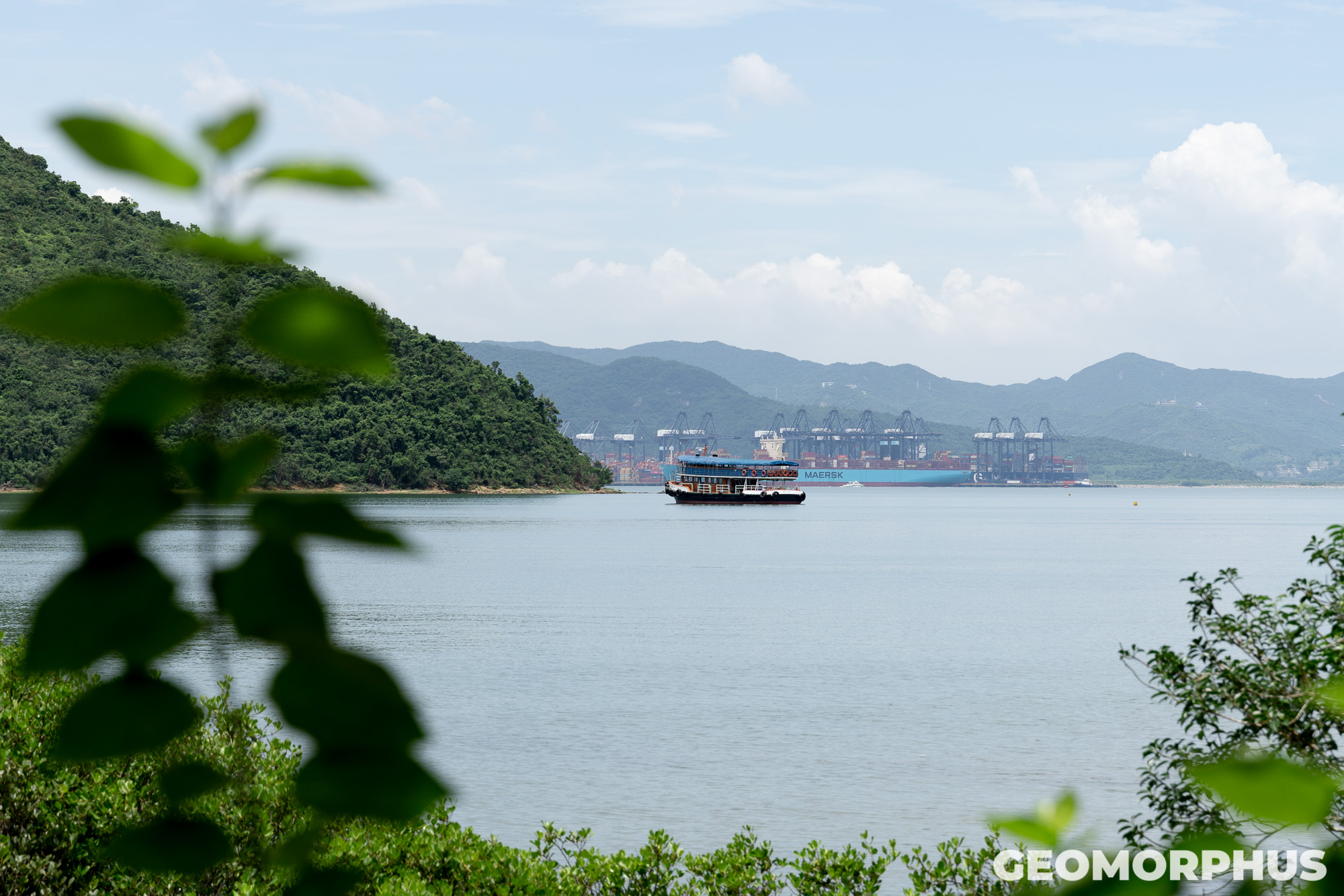
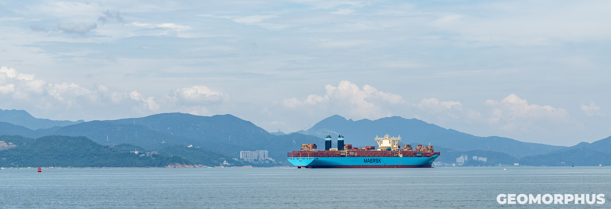
Rounding the top of the island, we note the stark proximity of Ap Chau, and the luscious wilderness of Plover Cove Country Park, to the intense shipping activity of Yantian Harbour. This provided an awesome juxtaposition, as the boat drifted along the border between Hong Kong and Mainland China. Yantian Harbour is part of the Port of Shenzhen, the 3rd largest container port in the world, and is hard evidence of the rapid infrastructure expansion occurring in China’s SEZs in our increasingly globalised world!
Such a contrast was a fitting end for our fantastic excursion to the Geopark. It was an experience that encouraged us to think beyond the stereotypical mental image of Hong Kong as a city of skyscrapers (although it certainly deserves its title as the world’s most vertical city!), by highlighting the beauty and value of the vast network of Country Parks in Hong Kong. This is especially noteworthy when you consider that the parks encompass 40% of Hong Kong’s total area, while less than 25% of land is developed! These parks are so valuable for Hong Kong, not only as a place for the urbanites to reconnect with nature, but also as a watershed to satiate the thirst of the significant population density of the urban areas.
The journey back was pretty amazing too - providing an opportunity to reflect on our experiences at Lai Chi Wo, alongside soaking in the beauty of our surroundings and socialising with other participants from across the globe.
Once we were back at EdUHK, the evening saw a continuation of this global networking. Backed by a chorus of frogs, it was a pleasure to meet other students from the Netherlands to Latvia, the USA to Estonia, Finland to Thailand, Australia to Bolivia, and from Belarus to Turkey, through a series of conversations, card games and Kindergarten playground games (which were thoroughly enjoyable, and played in a series of circles!).
Day 7 - Closing Ceremony (5th August)
Today was the closing ceremony - the final event of what was an absolutely incredible week!
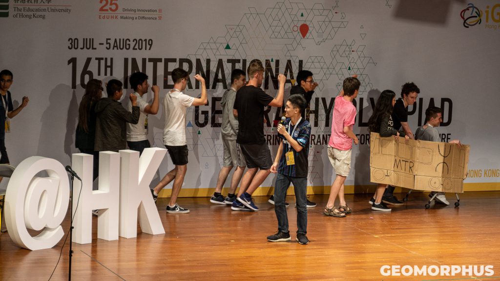
After talking to a few teams, some powerful concluding speeches from members of the iGeo taskforce, the local organising committee and IGU President Yukio Himiyama, the presentation of certificates of participation, and the poster results being announced, it was time for the medal ceremony! The atmosphere was enhanced even more due to the collective anticipation of our results! We were all pretty excited to say the least.
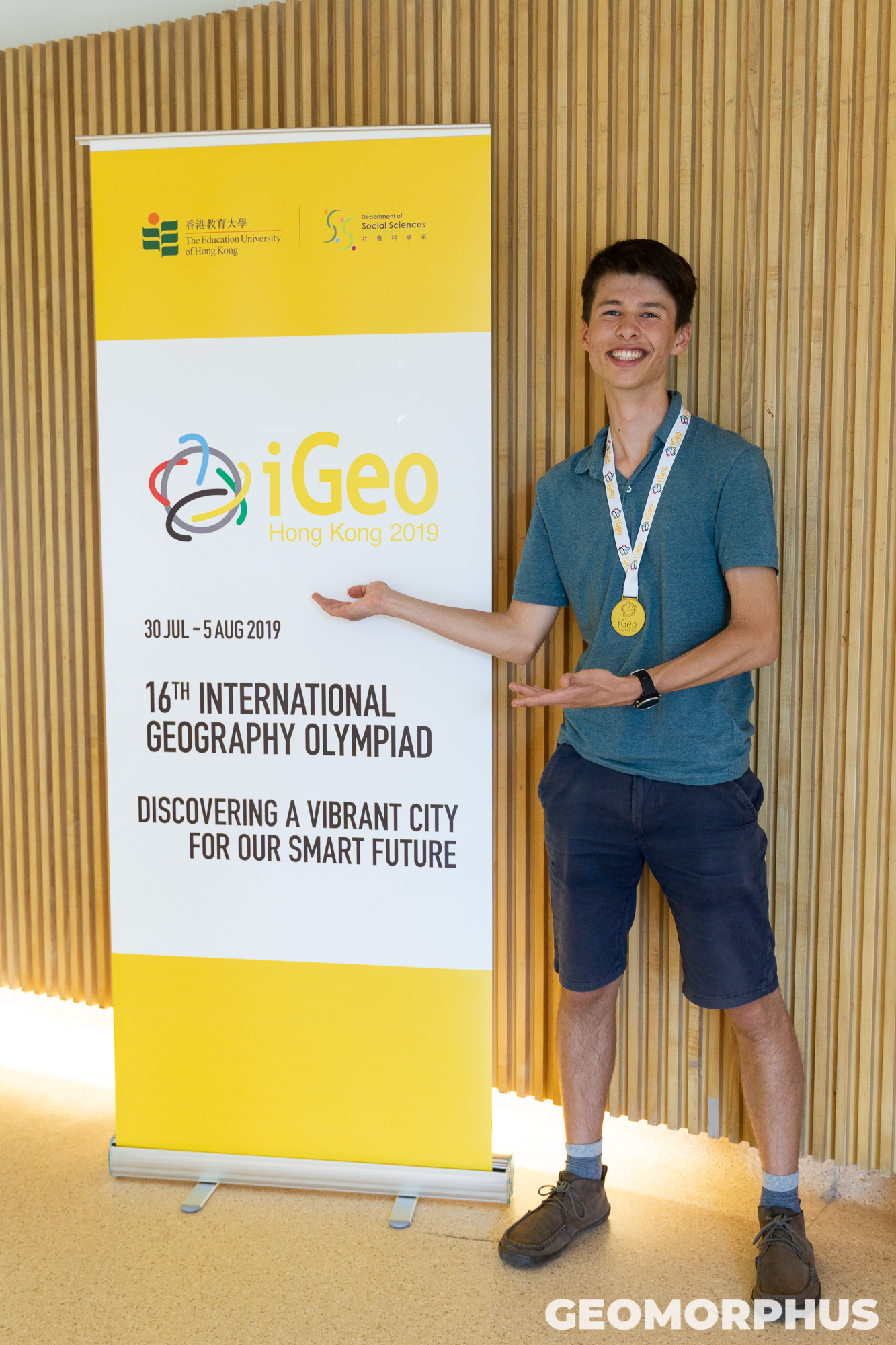
I was absolutely elated to be ranked 2nd in the world, receiving the UK’s first ever Gold medal at iGeo. That was pretty insane, and I’ve still not really got over it! I’m also so proud that, as Team UK at iGeo 2019, we ranked 3rd overall as a team: the UK’s best ever result!
I would like to take this opportunity to congratulate everyone who participated in iGeo this year for their outstanding achievements: both in terms of medals and the impressive feat of being selected to participate in iGeo from thousands in their respective countries! It was pretty awesome to be able to compete in a global event with such amazing and talented students from all over the world, all with a common passion for geography!
Although the ending of the Olympiad meant that I had to say goodbye to my new friends, I hope that someday our paths will cross again! The memories we forged, the good times we shared and the titbits I learnt about their countries will be remembered for sure.
Final Thoughts
iGeo 2019 in Hong Kong was an absolutely incredible experience. From making friends from all over the world, to reuniting with contacts I made in Québec last summer; and from exploring the luscious natural landscapes of the region, to encountering the vertical density of Hong Kong in Tai Po, it’s certainly been an amazing week - forging memories that will endure far into the future!
Doh Je Hoeng Gong! It’s been awesome.
Thank you to sponsors, organisers and participants
I would like to extend my deepest thanks to my sponsors, whose financial support was invaluable in covering the costs of participating at iGeo. They include Friends Provident International, UHY Crossleys, Lloyds Bank International, the Rotary Club of Rushen and Western Mann, my crowdfunding donors and my parents, who without which travelling to Hong Kong for iGeo wouldn’t have been possible!
There are also others that I’d like to thank for their support in my participation at iGeo. I would like to thank Team UK’s leaders for their enthusiasm, support and advice throughout, alongside their crucial role in making our participation at the Olympiad possible; the Geographical Association for their fantastic role in organising Team UK’s participation in iGeo; the iGeo Local Organising Committee for making the week run so smoothly; the IGU’s iGeo Task Force for being the overarching force that held the Olympiad together; the dedicated iGeo ambassadors in Hong Kong for their crucial role in the organisation of the Olympiad’s activities; and lastly, but by no means the least, the other iGeo Participants for making it such a special week in Hong Kong!